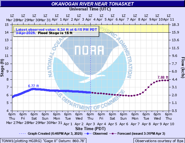
Okanogan River near Tonasket
Critical Stages
14' - Action
15' - Flood
17' - Moderate
18' - Major
Latest Observation
Updated: 7:15 AM PST 12/14/25
Status: No Flooding
Stage: 9.11 ft
Flow: 6.14 kcfs
Forecast
| Time | Stage (ft) | Flow (kcfs) |
|---|---|---|
| 10 AM 12/14 | 9.01 | 5.97 |
| 4 PM 12/14 | 8.96 | 5.89 |
| 10 PM 12/14 | 8.91 | 5.81 |
| 4 AM 12/15 | 8.86 | 5.72 |
| 10 AM 12/15 | 8.82 | 5.66 |
| 4 PM 12/15 | 8.78 | 5.59 |
| 10 PM 12/15 | 8.81 | 5.64 |
| 4 AM 12/16 | 9.04 | 6.02 |
| 10 AM 12/16 | 9.56 | 6.92 |
| 4 PM 12/16 | 10.27 | 8.24 |
| 10 PM 12/16 | 10.93 | 9.46 |
| 4 AM 12/17 | 11.4 | 10.4 |
| 10 AM 12/17 | 11.66 | 10.9 |
| 4 PM 12/17 | 11.75 | 11 |
| 10 PM 12/17 | 11.77 | 11.1 |
| 4 AM 12/18 | 11.77 | 11.1 |
| 10 AM 12/18 | 11.71 | 11 |
| 4 PM 12/18 | 11.54 | 10.6 |
| 10 PM 12/18 | 11.28 | 10.1 |
| 4 AM 12/19 | 10.98 | 9.56 |
| 10 AM 12/19 | 10.71 | 9.06 |
| 4 PM 12/19 | 10.49 | 8.65 |
| 10 PM 12/19 | 10.31 | 8.32 |
| 4 AM 12/20 | 10.16 | 8.04 |
| 10 AM 12/20 | 10.04 | 7.81 |
| 4 PM 12/20 | 9.93 | 7.6 |
| 10 PM 12/20 | 9.83 | 7.42 |
| 4 AM 12/21 | 9.73 | 7.23 |
| 10 AM 12/21 | 9.64 | 7.07 |
| 4 PM 12/21 | 9.55 | 6.9 |
| 10 PM 12/21 | 9.46 | 6.74 |
| 4 AM 12/22 | 9.38 | 6.6 |
| 10 AM 12/22 | 9.3 | 6.46 |
| 4 PM 12/22 | 9.23 | 6.34 |
| 10 PM 12/22 | 9.16 | 6.22 |
| 4 AM 12/23 | 9.09 | 6.11 |
| Time | Stage (ft) | Flow (kcfs) |
|---|---|---|
| 7:15 AM 12/14 | 9.11 | 6.14 |
| 7:00 AM 12/14 | 9.12 | 6.16 |
| 6:45 AM 12/14 | 9.12 | 6.16 |
| 6:30 AM 12/14 | 9.12 | 6.16 |
| 6:15 AM 12/14 | 9.12 | 6.16 |
| 6:00 AM 12/14 | 9.13 | 6.17 |
| 5:45 AM 12/14 | 9.12 | 6.16 |
| 5:30 AM 12/14 | 9.13 | 6.17 |
| 5:15 AM 12/14 | 9.13 | 6.17 |
| 5:00 AM 12/14 | 9.14 | 6.19 |
| 4:45 AM 12/14 | 9.14 | 6.19 |
| 4:30 AM 12/14 | 9.14 | 6.19 |
| 4:15 AM 12/14 | 9.14 | 6.19 |
| 4:00 AM 12/14 | 9.14 | 6.19 |
| 3:45 AM 12/14 | 9.14 | 6.19 |
| 3:30 AM 12/14 | 9.14 | 6.19 |
| 3:15 AM 12/14 | 9.14 | 6.19 |
| 3:00 AM 12/14 | 9.14 | 6.19 |
| 2:45 AM 12/14 | 9.15 | 6.21 |
| 2:30 AM 12/14 | 9.15 | 6.21 |
| 2:15 AM 12/14 | 9.15 | 6.21 |
| 2:00 AM 12/14 | 9.16 | 6.22 |
| 1:45 AM 12/14 | 9.16 | 6.22 |
| 1:30 AM 12/14 | 9.16 | 6.22 |
| 1:15 AM 12/14 | 9.17 | 6.24 |
| 1:00 AM 12/14 | 9.17 | 6.24 |
| 12:45 AM 12/14 | 9.17 | 6.24 |
| 12:30 AM 12/14 | 9.18 | 6.26 |
| 12:15 AM 12/14 | 9.18 | 6.26 |
| 12:00 AM 12/14 | 9.19 | 6.27 |
22' -
Severe flooding of surrounding cropland is likely. Damage is possible to numerous homes, outbuildings, irrigation systems and roads adjacent to the river. Water will be over Highway 97 near Ellisford and other areas between Tonasket and Oroville.
19.5' -
Buildings along the river on Brooks Tract Road in East Omak will be flooded and utilities will be impacted.
19' -
Water may be into homes along the river in and near Tonasket. Water will start to come over the banks at Brooks Track Rd in East Omak.
18' -
Water will be approaching homes along the river in and near Tonasket. Major flooding of surrounding cropland is likely. Some homes and buildings adjacent to the river will experience some basement and first floor flooding.
17' -
Low lying fields and pasture land in the flood plain along the Okanogan river valley, from Oroville to Okanogan, will be flooded. Some homes near the river in Okanogan may experience some basement flooding from seepage. Water will be between the railroad and Highway 97 near Ellisford to south Oroville. Water will be against the shoulder of Omak River Road across from Wanacut Creek.
16' -
Pasture land between Rodeo Track Road and Benton Street, on the east side of the river near Omak, will begin to flood. Flooding increases between Tonasket and Oroville.
15.5' -
Minor flooding in low lying areas and pasture lands is likely from Omak to Tonasket, especially near Ellisford.
15' -
Minor flooding of low lying areas and pasture lands is possible between Highway 7 and 97 from Oroville to Riverside.
| Date | Stage (ft) |
|---|---|
| Jun 2, 1972 | 22.54 |
| May 31, 1948 | 21.79 |
| May 12, 2018 | 19.71 |
| Jun 19, 1974 | 18.79 |
| Jun 18, 1950 | 18.66 |
| Apr 27, 1934 | 18.31 |
| Jun 14, 1955 | 18.12 |
| May 17, 1949 | 18.05 |
| May 18, 1997 | 17.8 |
| Jun 11, 2011 | 17.62 |
| May 23, 1991 | 17.37 |
| May 26, 1956 | 17.37 |
| May 15, 2013 | 17.15 |
| Jun 2, 2017 | 17.04 |
| Jun 2, 1986 | 16.88 |
| May 25, 1951 | 16.77 |
| May 22, 1957 | 16.71 |
| Jun 6, 1961 | 16.59 |
| May 28, 1938 | 16.51 |
| Jun 12, 1964 | 16.3 |
Data provided by the National Weather Service.