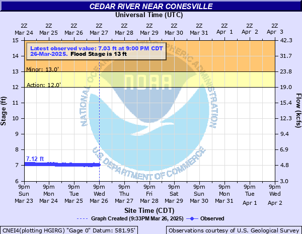
Cedar River near Conesville
Critical Stages
12' - Action
13' - Flood
15' - Moderate
16.5' - Major
Latest Observation
Updated: 9:00 AM CST 12/14/25
Status: No Flooding
Stage: 5.29 ft
Flow: 1.41 kcfs
Forecast
Forecast not available for this location.
| Time | Stage (ft) | Flow (kcfs) |
|---|---|---|
| 9:00 AM 12/14 | 5.29 | 1.41 |
| 8:45 AM 12/14 | 5.29 | 1.41 |
| 8:30 AM 12/14 | 5.3 | 1.42 |
| 8:15 AM 12/14 | 5.3 | 1.42 |
| 8:00 AM 12/14 | 5.3 | 1.42 |
| 7:45 AM 12/14 | 5.29 | 1.41 |
| 7:30 AM 12/14 | 5.29 | 1.41 |
| 7:15 AM 12/14 | 5.29 | 1.41 |
| 7:00 AM 12/14 | 5.29 | 1.41 |
| 6:45 AM 12/14 | 5.29 | 1.41 |
| 6:30 AM 12/14 | 5.29 | 1.41 |
| 6:15 AM 12/14 | 5.29 | 1.41 |
| 6:00 AM 12/14 | 5.29 | 1.41 |
| 5:45 AM 12/14 | 5.29 | 1.41 |
| 5:30 AM 12/14 | 5.32 | 1.44 |
| 5:15 AM 12/14 | 5.31 | 1.43 |
| 5:00 AM 12/14 | 5.32 | 1.44 |
| 4:45 AM 12/14 | 5.34 | 1.47 |
| 4:30 AM 12/14 | 5.36 | 1.49 |
| 4:15 AM 12/14 | 5.38 | 1.51 |
| 4:00 AM 12/14 | 5.4 | 1.54 |
| 3:45 AM 12/14 | 5.41 | 1.55 |
| 3:30 AM 12/14 | 5.43 | 1.58 |
| 3:15 AM 12/14 | 5.44 | 1.59 |
| 3:00 AM 12/14 | 5.45 | 1.6 |
| 2:45 AM 12/14 | 5.47 | 1.63 |
| 2:30 AM 12/14 | 5.48 | 1.64 |
| 2:15 AM 12/14 | 5.49 | 1.65 |
| 2:00 AM 12/14 | 5.49 | 1.65 |
| 1:45 AM 12/14 | 5.49 | 1.65 |
23.5' -
Water is at the bottom of the County Road X40 and F36 bridge near Cedar Valley.
23' -
Water is at the bottom of the U.S. Highway 6 bridge near Moscow.
22.5' -
Water is at the bottom of the I-80 bridge.
22' -
Water affects several residences near Moscow and is at the bottom of the Iowa Highway 22 and County Road G28 bridges.
21.5' -
Water affects the lowest sections of County Road F44 near the river at Rochester.
21' -
Water is at the bottom of the Iowa Highway 22 and County Road G28 bridges.
20' -
Water affects the lowest sections of County Road F70 near the river.
19' -
Water affects the lowest sections of U.S. Highway 6 near the river and is at the bottom of the County Road F70 bridge. Water also affects some residences in Port Allen.
18' -
Water affects several residences in the Rochester area and is at the bottom of the County Road F44 bridge. Water also affects the lowest areas of West Rochester Avenue and affects residences in Moscow.
17' -
Water affects permanent structures and roads in campgrounds just north of I-80 along the river. Water is also on the lowest areas of Atalissa Road.
16.5' -
Water affects County Road G28.
15.5' -
Water affects residences along County Road G28 and affects several gravel roads.
15' -
Water affects Saulsbury Road.
14.5' -
Water affects residences along Iowa Highway 22. Water affects Hoot Owl Jct and Elder Avenue south of Iowa Highway 22.
14.2' -
Water affects Lindle Avenue and Keokuk Avenue, both near Saulsbury Park.
14' -
Water affects residences along County Road F70.
13.5' -
Water affects yards and access roads of residences along Iowa Highway 22. Water affects the lowest sections of campgrounds just north of I-80 along the river and the lowest sections of Jack Shuger Memorial Park in Moscow. Water is also on 152nd Street north of County Road F70.
13' -
Water affects Edgewater Road and 245th Street near Conesville.
12' -
Water affects low lying access roads to recreational properties along the river.
| Date | Stage (ft) |
|---|---|
| Jun 15, 2008 | 23.4 |
| Sep 29, 2016 | 18.06 |
| Jul 2, 2014 | 17.88 |
| Oct 1, 2016 | 17.38 |
| Apr 6, 1993 | 17.11 |
| May 29, 2004 | 17 |
| Jun 3, 2013 | 16.9 |
| Jun 18, 1990 | 16.87 |
| Apr 12, 1965 | 16.85 |
| Jul 28, 1999 | 16.8 |
| Jul 7, 1993 | 16.74 |
| Apr 2, 1961 | 16.62 |
| Feb 25, 1985 | 16.56 |
| Jul 20, 1993 | 16.42 |
| Sep 28, 2018 | 16.41 |
| Mar 20, 2019 | 16.31 |
| May 22, 1999 | 16.3 |
| Apr 30, 2008 | 16.2 |
| Jul 15, 1969 | 16.05 |
| May 31, 2019 | 16.04 |
Data provided by the National Weather Service.